October 23, 2010:
A very active weather pattern is developing.
Good morning!
I will update this post/page with new information through tonight. So, check back for updates.
Red flag warning is in effect today. That basically means - PLEASE don't burn anything outside. Fire danger is high.
Clouds have increased overnight. This is in response to a storm system to our west. I believe most of today will be dry. Can't rule out a stray shower - especially across the western half of the area and northwestern portions, as well.
Our rain/storm chances will increase on Sunday - mostly Sunday afternoon and evening. Best chances will probably be after 3 pm Sunday and into Sunday night. Most of us should receive some rainfall. It does not look like a huge event. But, some rain nonetheless.
There will be a few strong thunderstorms on Sunday. The Storm Prediction Center has outlined a region to our south and west. They do have us in low probabilities for severe weather, as well. Gusty winds and hail would be the main threat. This is a low threat. But - there is at least a small chance of severe storms.
A better chance of severe storms will be to our south in Arkansas, Tennessee, Louisiana, and Mississippi.
Another storm system will impact our region on Monday night into Tuesday night. There are differing opinions on the extent of rainfall with the second system and the severe weather threat. The SPC has not outlined a region, yet. I was a bit surprised by this. I believe there will be some severe risk from the Missouri Valley into the Ohio Valley. Perhaps in later updates they will outline a risk region. Stay tuned - this could be a wind event.
If they do outline an area then I would not be surprised if it didn't include portions of Iowa, Missouri, Illinois, Michigan, Indiana, Kentucky, Ohio, Pennsylvania, New York, and West Virginie. I am a bit more unsure about areas further to the south (this is for the Monday afternoon into Tuesday event that I am talking about). We will see.
The wind energy with the Monday/Tuesday storm is quite amazing. If a line of thunderstorms can develop ahead of the cold front then high winds would be a likelihood. Stay tuned for updates on the Monday/Tuesday system, as well.
Sensible weather -
Mostly dry across our region today - increasing clouds. Mild.
Slight chance for showers late tonight and Sunday morning.
Rain chances increase on Sunday afternoon and Sunday night. A few strong storms possible.
Another shot at showers and thunderstorms on Monday night and Tuesday. Severe storms are possible. Windy, as well.
A look ahead -
I am watching a storm system for October 30-November 2nd. Depending on the speed of the system, we may have to think about rain chances on Halloween. I am hoping that Saturday will remain dry - although this is not for certain. I know most Halloween activities are going to fall on the 30th vs the 31st. I will update through the week.
Couple of maps and links
For the very latest severe weather outlooks visit the Storm Prediction Center web-site. Click here.
If you would like to view our regional radar or local radar - Click here.
Your official NWS seven day forecast - Click here
The above map is the HPC rainfall forecast for the next five days - broad-brushed - but you get the general idea of what is expected. Again, not everyone will experience these exact amounts.
The above map is the severe weather outlook for Sunday and Sunday night. This is from the Storm Prediction Center (SPC). You can see that they have us in very low probabilities for severe weather.
The above map shows the slight risk area - the other area (surrounding the slight risk area) is outlined for general thunderstorms. This is the official SPC forecast.
The above map shows some tornado potential to our south on Sunday night/Monday.
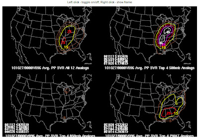
One chart that I look at - above - defin is hitting on the Monday/Tuesday event. Showing some potential for severe weather.
- Meteorologist Beau Dodson
McCracken County Office of Emergency Management
For the latest watches and warnings please visit your local National Weather Service Office http://www.weather.gov/organization.php


No comments:
Post a Comment