Wednesday evening into Thursday afternoon update
.
For more frequent updates check out the weather Facebook page - click here and hit like at the top of the page.
.
This page is best viewed with Mozilla Firefox. There could be issues with spacing on Internet Explorer
.

.
Here are my current personal forecast thoughts for far southern Illinois and western Kentucky...
.
Wednesday night: Mostly cloudy with rain developing - a rumble of thunder possible.
Above normal temperatures
Lows: in the middle to upper 50s | Normal lows for this time of the year are around 32 degrees.Above normal temperatures
Wind: Southerly winds at 10-15 mph. Gusty
Precipitation probability - 70% | Rainfall totals: 0.25"
Confidence in this forecast is very high
.
Thursday: A chance for showers - thunderstorms possible. Turning cooler in the afternoon.
Above normal temperatures
Highs: around 65 degrees then falling temperatures in the afternoon. | Normal highs for this time of the year are around 52 degrees.Above normal temperatures
Wind: Southwest winds becoming more northerly at 10-15 mph and gusty
Precipitation probability - 80% | Rainfall totals: 025"-0.50" locally heavier amounts likely
Confidence in this forecast is very high
.
Thursday night: Showers and possibly a rumble of thunder - rain diminishing after midnight.
Above normal temperatures
Above normal temperatures
Lows: in the middle 40s | Normal lows for this time of the year are around 32 degrees.
Wind: Northeast at 10-15 mph and gusty
Precipitation probability - 80% | Rainfall totals: 0.50"-1.00" locally heavier amounts possible
Confidence in this forecast is high
Wind: Northeast at 10-15 mph and gusty
Precipitation probability - 80% | Rainfall totals: 0.50"-1.00" locally heavier amounts possible
Confidence in this forecast is high
.
Friday: Becoming partly to mostly sunny.
Near normal temperatures
Highs: around 55 degrees | Normal highs for this time of the year are around 52 degrees.Wind: Northeast winds at 10-15 mph and gusty at times
Precipitation probability - 10% early | Rainfall totals: After 8 am = 0"
Confidence in this forecast is high
.
Don't forget to sign up for the severe weather "heads up" email list - I usually email everyone before a big event - severe weather or winter storms - ice storms. Click here to join
.

.
.
Don't forget to sign up for the severe weather "heads up" email list - I usually email everyone before a big event - severe weather or winter storms - ice storms. Click here to join
.
.

Showers and thunderstorms will move back into the forecast later tonight and will continue into Thursday night. There could be some heavy downpours. I am not expecting any severe weather.

No - but use caution if boating - it will continue to be windy.

Wild card in the forecast will be just how much it rains over the next 48 hours. Appears a widespread 0.50"-1.00" across the region. Would not be a bit surprised to see some reporting stations end up with 1"-2" of rain. This is especially true over the southern counties.
.
.

No significant snow in this short range forecast...
.

.
.
.
No major changes in this update!
.

.
Forecast for your local town/city - Click Here
.
..
Join me on Facebook for more frequent updates on the weather in our local areaClick Here.
.
---

The forecast for severe or extreme weather for the next 48 hours
.
The McCracken County Office of Emergency Management reminds you that owning a NOAA All Hazards Weather Radio is the best way to receive notifications of severe weather watches and warnings.
.
Remember that the National Weather Service defines a severe thunderstorm as one that produces 58 mph winds or higher, hail 1" in size or larger, and/or a tornado. More information with some slides concerning reporting severe weather - click here
.
For the most up to date severe weather outlooks - click here.
or
Visit the Storm Prediction Center's web-site - click here
.
Wednesday night: Severe weather is not anticipated. No snow or ice.
Wednesday night: Will there be a chance for non-severe thunderstorms? Yes
.
.
Wednesday night: Severe weather is not anticipated. No snow or ice.
Wednesday night: Will there be a chance for non-severe thunderstorms? Yes
.
Thursday: Severe weather is not anticipated. No snow or ice.
Thursday: Will there be a chance for non-severe thunderstorms? Yes
.Thursday: Will there be a chance for non-severe thunderstorms? Yes
Thursday night : Severe weather is not anticipated. No snow or ice.
Thursday night: Will there be a chance for non-severe thunderstorms? Yes
.
Friday: Severe weather is not anticipated. No snow or ice.
Friday: Will there be a risk for non-severe thunderstorms? No
.
.
 .
.
Will the Storm Prediction Center issue a tornado or severe thunderstorm watch for southeast Missouri, southern Illinois, or western Kentucky?
.
Thursday - No
Friday - No
Saturday - No
Friday: Will there be a risk for non-severe thunderstorms? No
.
.
Will the Storm Prediction Center issue a tornado or severe thunderstorm watch for southeast Missouri, southern Illinois, or western Kentucky?
.
Thursday - No
Friday - No
Saturday - No
Sunday - No
Monday - No
Tuesday - No

.
To view all watches and warnings in IL - Click Here
To view all watches and warnings in KY - Click Here
To view all watches and warnings in MO - Click Here
To view all watches and warnings in TN - Click Here
All other states- Click Here
To view all watches and warnings in IL - Click Here
To view all watches and warnings in KY - Click Here
To view all watches and warnings in MO - Click Here
To view all watches and warnings in TN - Click Here
All other states- Click Here
.
The links above are interactive and you can move around the United States by simply clicking on the national map - or from the pull down menu where it says regions and US States.
.
To view the interactive map - click here.
.
To view the interactive map - click here.
.
.

This forecast analysis covers far southern Illinois, southeast Missouri, southwest Indiana, western Kentucky, and northwest Tennessee - for your local town/area - click here
.
HEADLINE: Rain will move into the region tonight - rain will continue into Thursday evening. Right now it appears that the heaviest rainfall totals will be over the central and southern half of the region - especially the southern half. Portions of Arkansas and Tennessee may pick up several inches of rain over the next 5-6 days.
.
The good news is that I do not believe we will be dealing with severe weather. More of a general rainfall event with some rumbles of thunder.
.
Friday will be dry and Saturday will be mostly dry - rain showers could return on Saturday night and especially on Sunday.
.
Different computer guidance is spitting out different numbers on the rainfall totals - right now it appears that most of us will pick up 1-2 inches of rain between now and Monday. Here are some maps showing different opinions - one model vs another.
.
Maps are from StormVista and www.wright-weather.com
.
Click images for full size views - this is the GFS model for the next 5 days - check out some of those rain totals to our south and southwest. Heavy rain.
.

.
Here is the high resolution NAM solutions for rainfall - this map shows you the rainfall for the next 48 hours
.

.
Another model showing similar totals. Again this is the 48 hour rainfall total forecast. Click images for full size view. You get the general idea - the heaviest rain is forecast to fall near the KY/TN border and then south and southwest of there. Quite a bit of rain - at that.
.

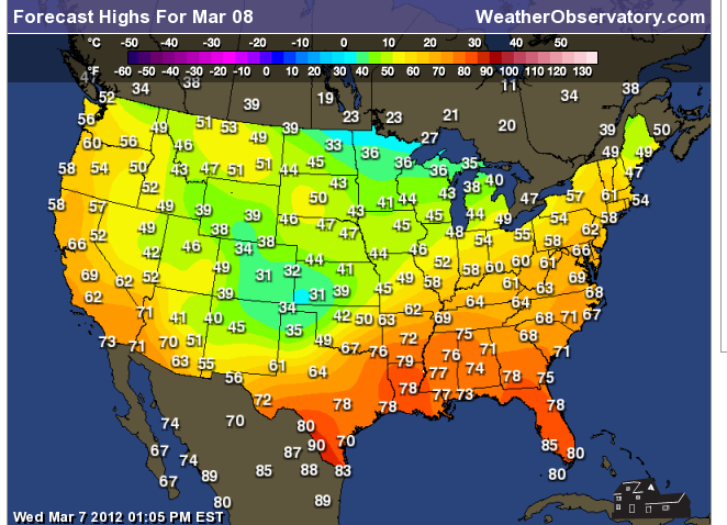
Temperatures the next few days will continue to be fairly mild - especially for early March. Generally above normal - temperatures will cool a bit behind the front on Thursday afternoon. Temperatures will actually fall on Thursday afternoon - gusty winds, as well.
.
Forecast highs for the next few days - into the weekend.
.


We have a TON of new weather maps on the Weather Observatory web-site - these include temperatures, wind speed, dew points, heat index, barometric pressure, predicted rainfall, climate forecast, medium and long range maps, forecasts and more! Click here
.
HEADLINE: Rain will move into the region tonight - rain will continue into Thursday evening. Right now it appears that the heaviest rainfall totals will be over the central and southern half of the region - especially the southern half. Portions of Arkansas and Tennessee may pick up several inches of rain over the next 5-6 days.
.
The good news is that I do not believe we will be dealing with severe weather. More of a general rainfall event with some rumbles of thunder.
.
Friday will be dry and Saturday will be mostly dry - rain showers could return on Saturday night and especially on Sunday.
.
Different computer guidance is spitting out different numbers on the rainfall totals - right now it appears that most of us will pick up 1-2 inches of rain between now and Monday. Here are some maps showing different opinions - one model vs another.
.
Maps are from StormVista and www.wright-weather.com
.
Click images for full size views - this is the GFS model for the next 5 days - check out some of those rain totals to our south and southwest. Heavy rain.
.

.
Here is the high resolution NAM solutions for rainfall - this map shows you the rainfall for the next 48 hours
.

.
Another model showing similar totals. Again this is the 48 hour rainfall total forecast. Click images for full size view. You get the general idea - the heaviest rain is forecast to fall near the KY/TN border and then south and southwest of there. Quite a bit of rain - at that.
.

Temperatures the next few days will continue to be fairly mild - especially for early March. Generally above normal - temperatures will cool a bit behind the front on Thursday afternoon. Temperatures will actually fall on Thursday afternoon - gusty winds, as well.
.
Forecast highs for the next few days - into the weekend.
.
We have a TON of new weather maps on the Weather Observatory web-site - these include temperatures, wind speed, dew points, heat index, barometric pressure, predicted rainfall, climate forecast, medium and long range maps, forecasts and more! Click here
.
I have also added a few new interactive city radars - including the Memphis, Tennessee area and the rest of the State of Kentucky.
.
.
-----------------------------
.

.
Let's check out the how much rain is forecast to fall over the next 24 hours. This map gives you a general broad brushed idea of what can be expected. Remember the scale is at the top of the map.
.
If you would like to view the most up to date 24, 48, 72, and 120 hour precipitation forecast maps then click here.
.

.
.
If you would like to view the most up to date 24, 48, 72, and 120 hour precipitation forecast maps then click here.
.
.
.

.
You can also now view the probability of X amount of rain (you pick the value on the web-site) in a six hour period of time. Those maps can be viewed here.
.
You can view drought maps on the Weather Observatory web-site by clicking here.
.

You can also now view the probability of X amount of rain (you pick the value on the web-site) in a six hour period of time. Those maps can be viewed here.
.
You can view drought maps on the Weather Observatory web-site by clicking here.
.
.
.
No significant snow in our forecast...
.
No significant snow in our forecast...
.
Enhanced snowfall interactive forecast maps . You can choose your total snowfall amounts above the map - time frame, as well- click here
.
Snowfall forecast maps - these are interactive maps. You can choose your total snowfall amounts above the map - time frame, as well - click here
Enhanced snowfall interactive forecast maps . You can choose your total snowfall amounts above the map - time frame, as well- click here
.
Snowfall forecast maps - these are interactive maps. You can choose your total snowfall amounts above the map - time frame, as well - click here
.
If you are looking for wintry precipitation - click here.
.
.

.
You can view the upcoming days high temperature and low temperature forecasts by clicking here - choose the day - click on your state to zoom in
You can view the upcoming days high temperature and low temperature forecasts by clicking here - choose the day - click on your state to zoom in
.
 .
. We have a number of new radars available on our Weather Observatory web-site!
---
We now offer St Louis, Mt Vernon, Evansville, Poplar Bluff, Cape Girardeau, Marion, Paducah, Hopkinsville, and Dyersburg Interactive City Radars. We also have the two regional radars and now offer you three GR Earth radars.
http://www.weatherobservatory.com/weather-radar.htm---
---
We also have a new interactive radar - you can view that radar by clicking here.
.
Want to learn more about how to use our radars? I made a how to video with more information
Click here - http://www.youtube.com/watch?v=bfLa0hI3adU
.
.
.
.
---

.
Date Range: March 4th-March 14th
Event: A few shots at precipitation - severe weather risk appears low (not zero but low).
Severe Risk: low
Frozen Precipitation Risk: Uncertain - most likely some rain events
Details: A few systems to monitor - right now it appears the severe weather risk is low.
Confidence in my forecast: Medium .
.
.
Date Range: March 14th-31st
Event: 3-5 systems to monitor.
Severe Risk: Can't rule out some heavier weather the last half of the month.
Frozen Precipitation Risk: Uncertain - most likely some rain events
Details:
Confidence in my forecast: Medium .
.
.
.
Remember that as a general policy, in the long range outlook, I will NOT mention severe thunderstorms more than 72 hours in advance. I will mention thunderstorm risks and I will give as many details as possible. The word severe will be reserved for the short range forecast.
.
-----------------------------
.
1. Rain returns by Sunday - some rumbles of thunder possible. Right now I do not see a threat for severe weather. That is the good news.
.
.
Now is a GREAT time to buy a NOAA All Hazards Weather Radio. Better to have one before storms strike than to be without one during an event. I recommend the Midland Model 300 NOAA All Hazards Weather Radio - that is what I use here at my house!
.
Meteorologist Beau DodsonMcCracken County Office of Emergency Management
.

.
Beau Dodson Weather - Facebook
.

To view all watches and warnings in Illinois - Click Here
To view all watches and warnings in Kentucky - Click Here
To view all watches and warnings in Missouri - Click Here
To view all watches and warnings in Tennessee - Click Here
.
All other states- Click Here
.
For the latest watches and warnings please visit your local National Weather Service Office web-site.
http://www.weather.gov/organization.php
.
Remember most of these maps can be viewed straight off of the Weather Observatory Web-Site
.

.
No comments:
Post a Comment